⏱ ~7 min read
Windy.app helps you decide when to go out (and when not to) using wind and weather forecasts for your exact spot.
In this guide, you'll learn to:
- Check the weather in under a minute
- Understand what you see
- Make better decisions
Navigation — jump to any section:
1. Start in 60 seconds
Check where and when to go out in under a minute. Three steps:
1) Find a good spot
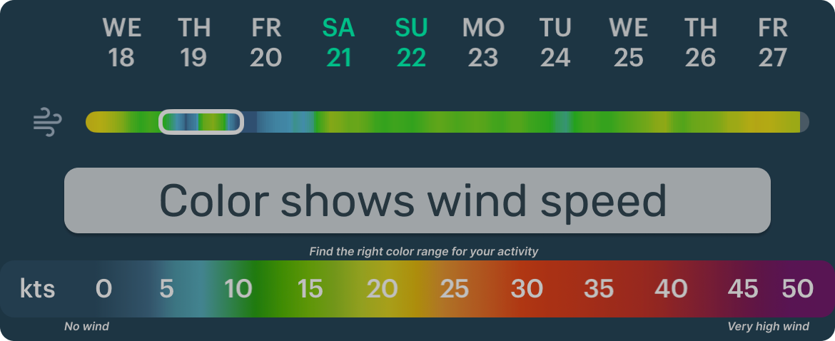
If you need steady wind, start with the wind color scale:

Then look for that color on the map:
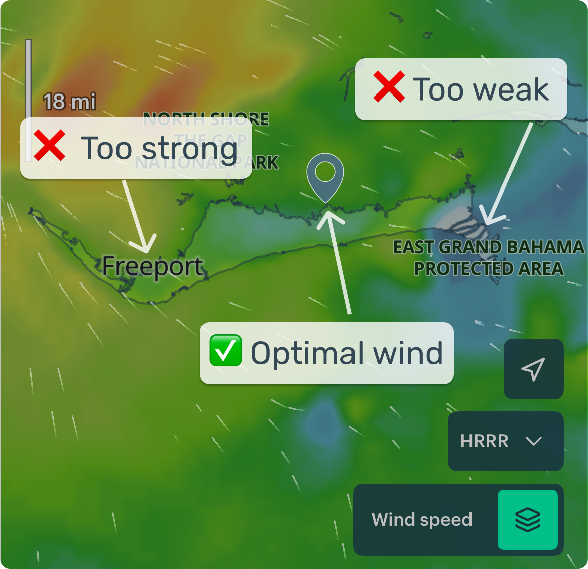
'Optimal' depends on your activity (kite, sailing, etc.), of course. If wind isn't that important — check gusts, rain, swell, water temperature, or add overlays like fog and fronts.
2) Open the detailed forecast
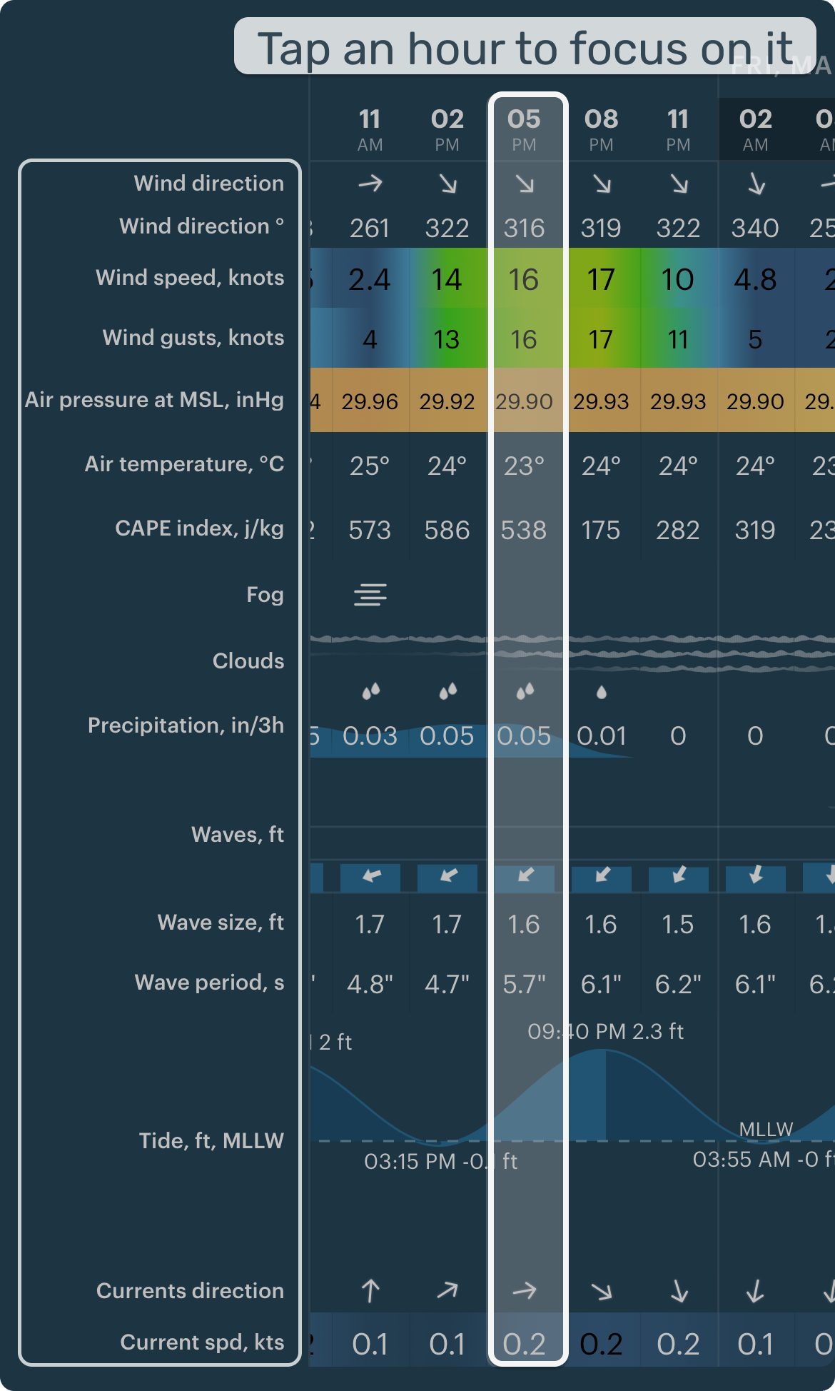
Start with the basics — wind, gusts, and rain.
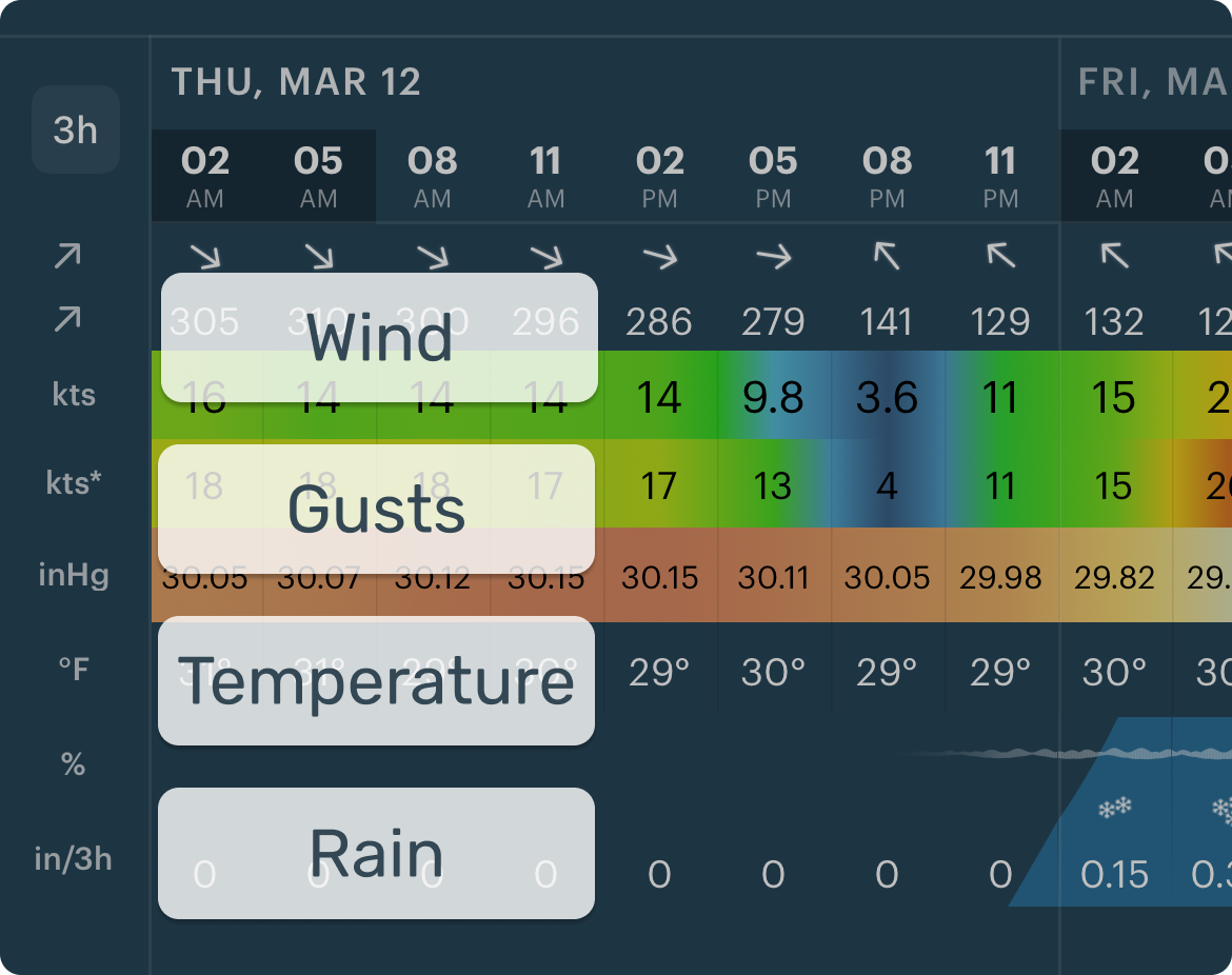
Check more details if needed — like waves, currents, or temperature.
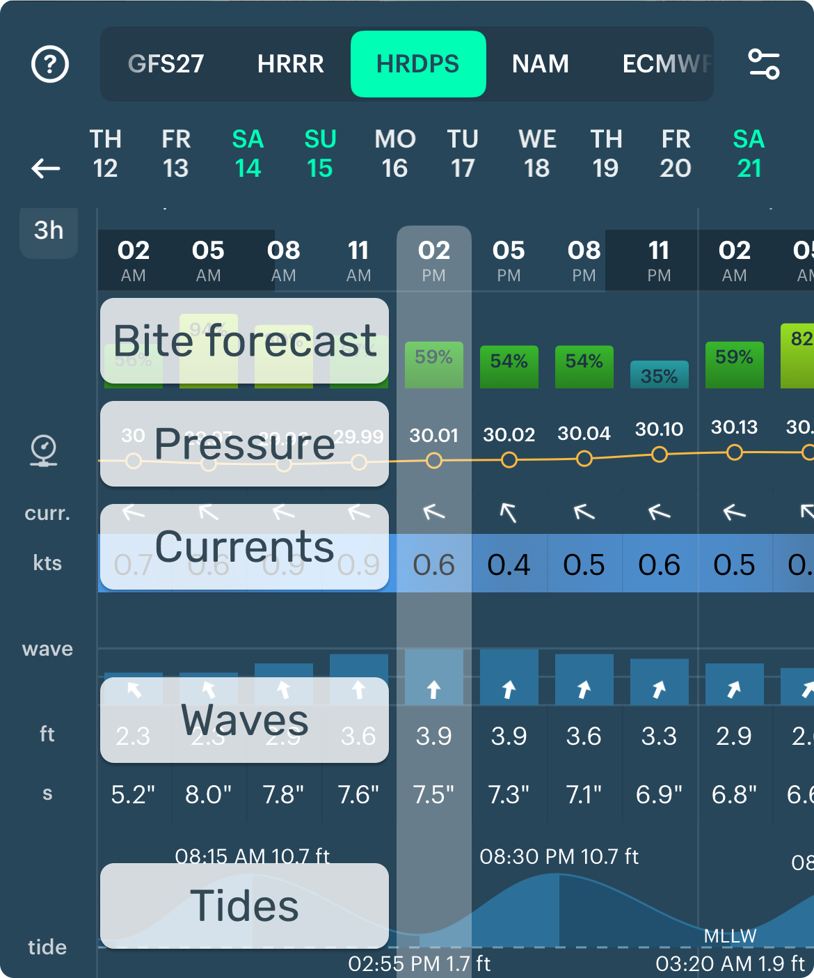
Don't see what you need? Use presets for different activities (Settings → Profile).
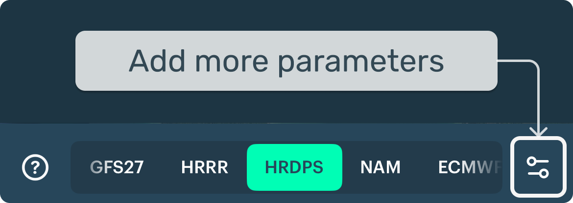
3) Compare models (optional)
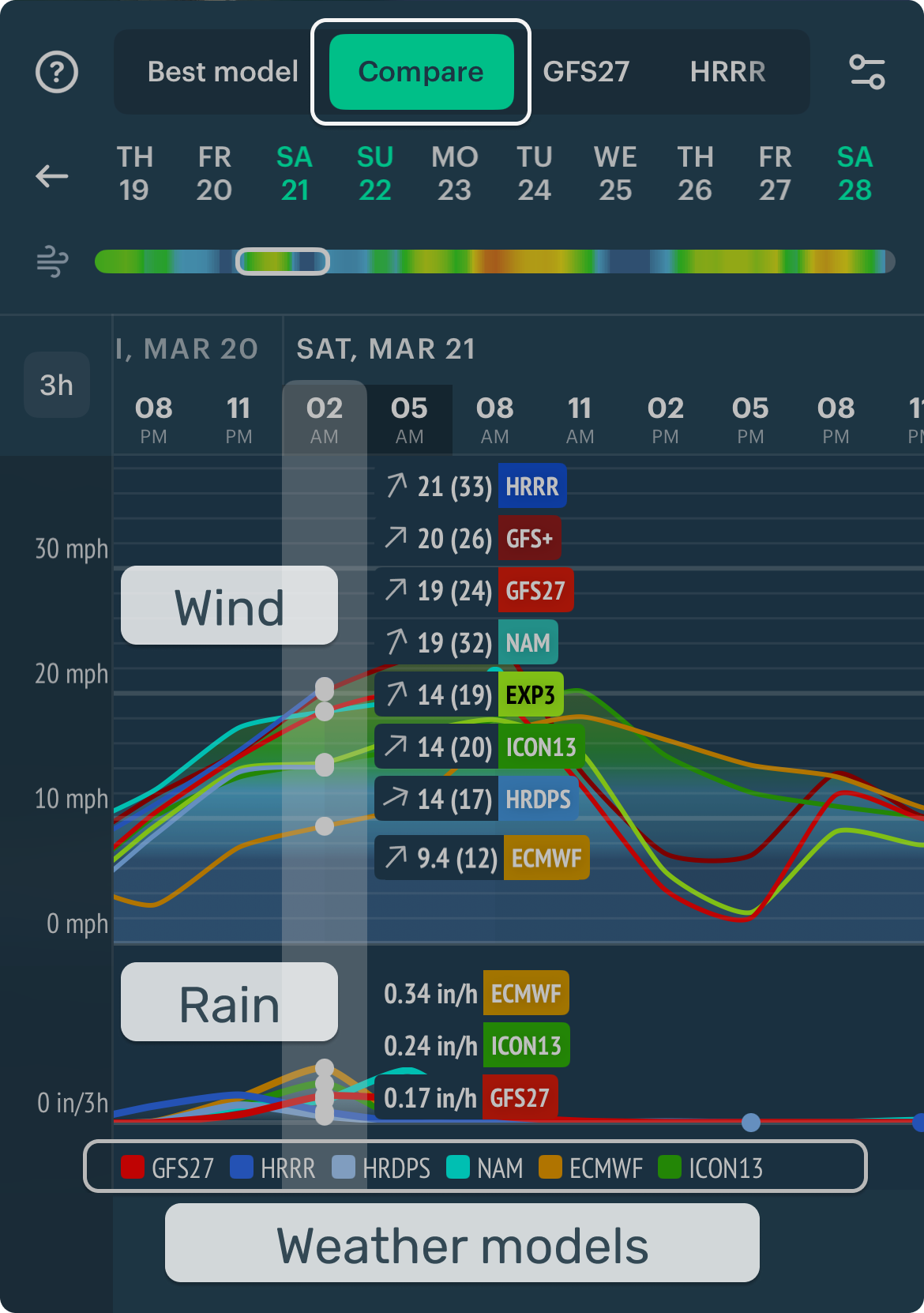
Each model gives a slightly different forecast. Comparing them shows how reliable it is. You don't need to understand how models work — just follow the steps below.
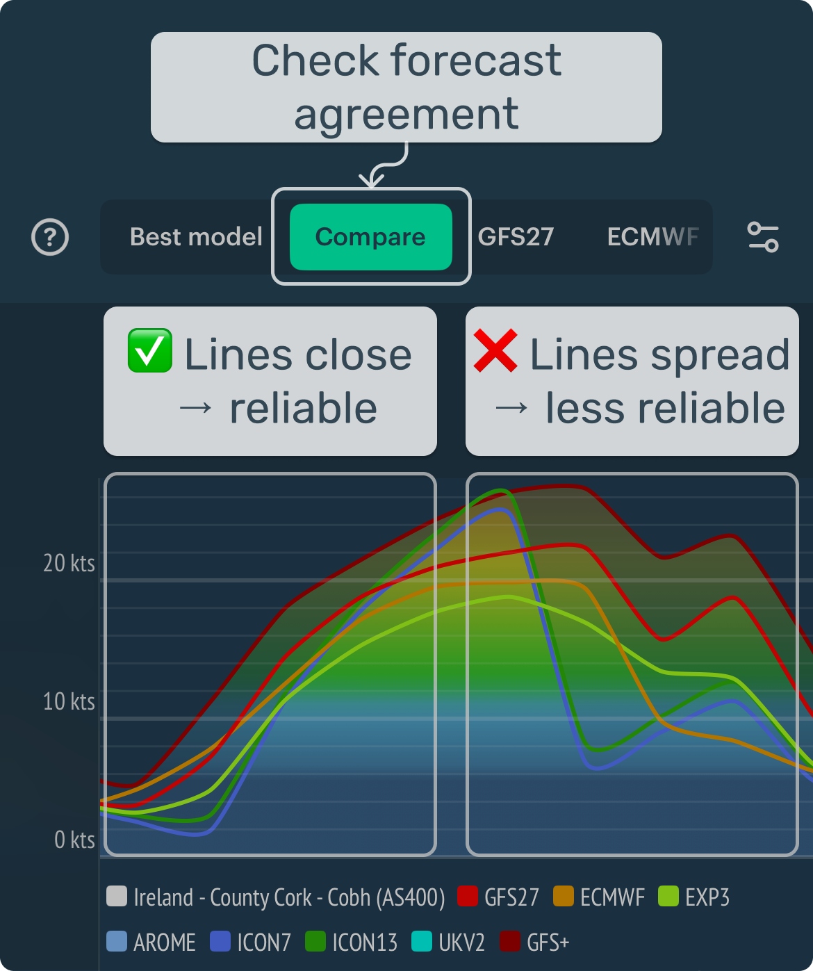
Each line shows wind from a different weather model.
Meteorologist tip:
- If models agree → higher confidence
- If not → expect uncertainty. Postpone, choose another spot, or wait for the next update (~6 hours)
After you do this a few times, reading a forecast becomes fast and intuitive.
2. Right before you go: 3 quick checks
Real-life conditions can change faster than the forecast updates. These three quick checks help you make safer decisions.
1) Rain radar check
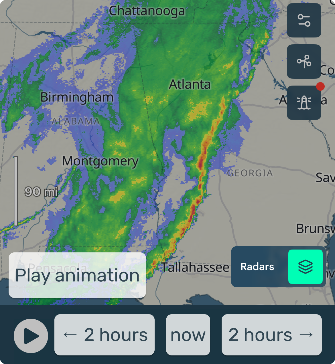
- Radar shows real rain now (not a forecast) within ~100–200 km.
- Windy.app adds a short 2-hour forecast (nowcasting).
- Tap Play to see how rain moves.
On the topic of fast-changing weather — see how far this rain band moved in just 2.5 hours:
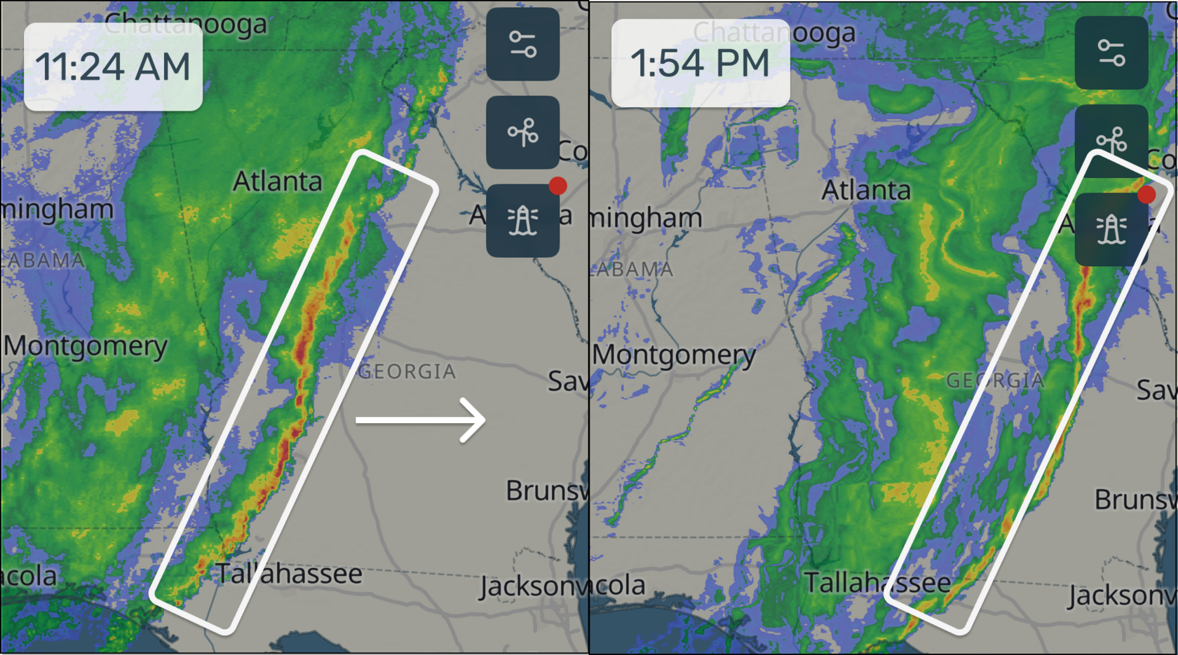
Meteorologist tip: A long, fast-moving rain band is often a cold front. It can bring a wind shift and stronger gusts, showers and thunderstorms, and a temperature drop after passage.
2) Live wind (weather stations) check
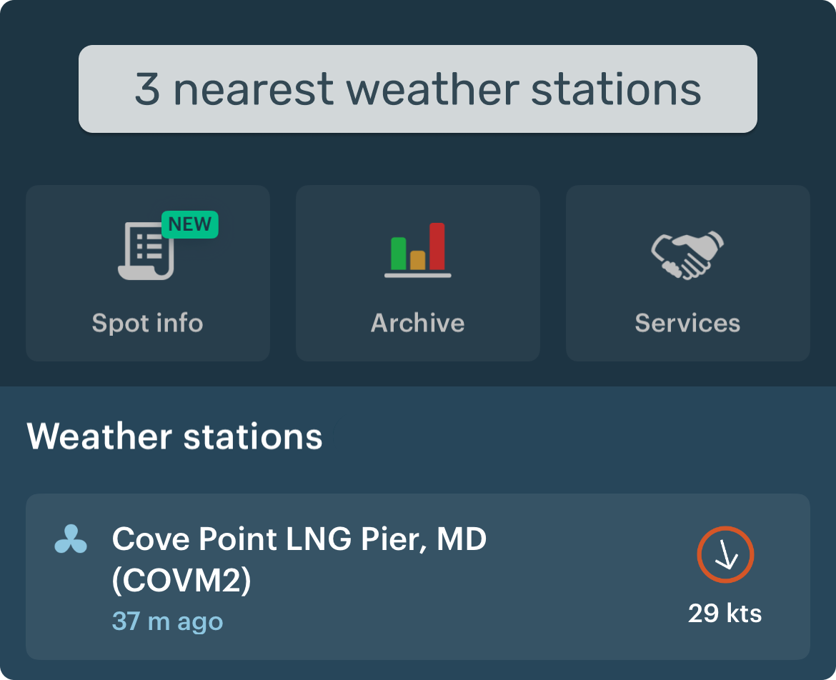
- Weather stations show real wind and gusts — not a forecast.
- The forecast can be wrong. Stations show reality.
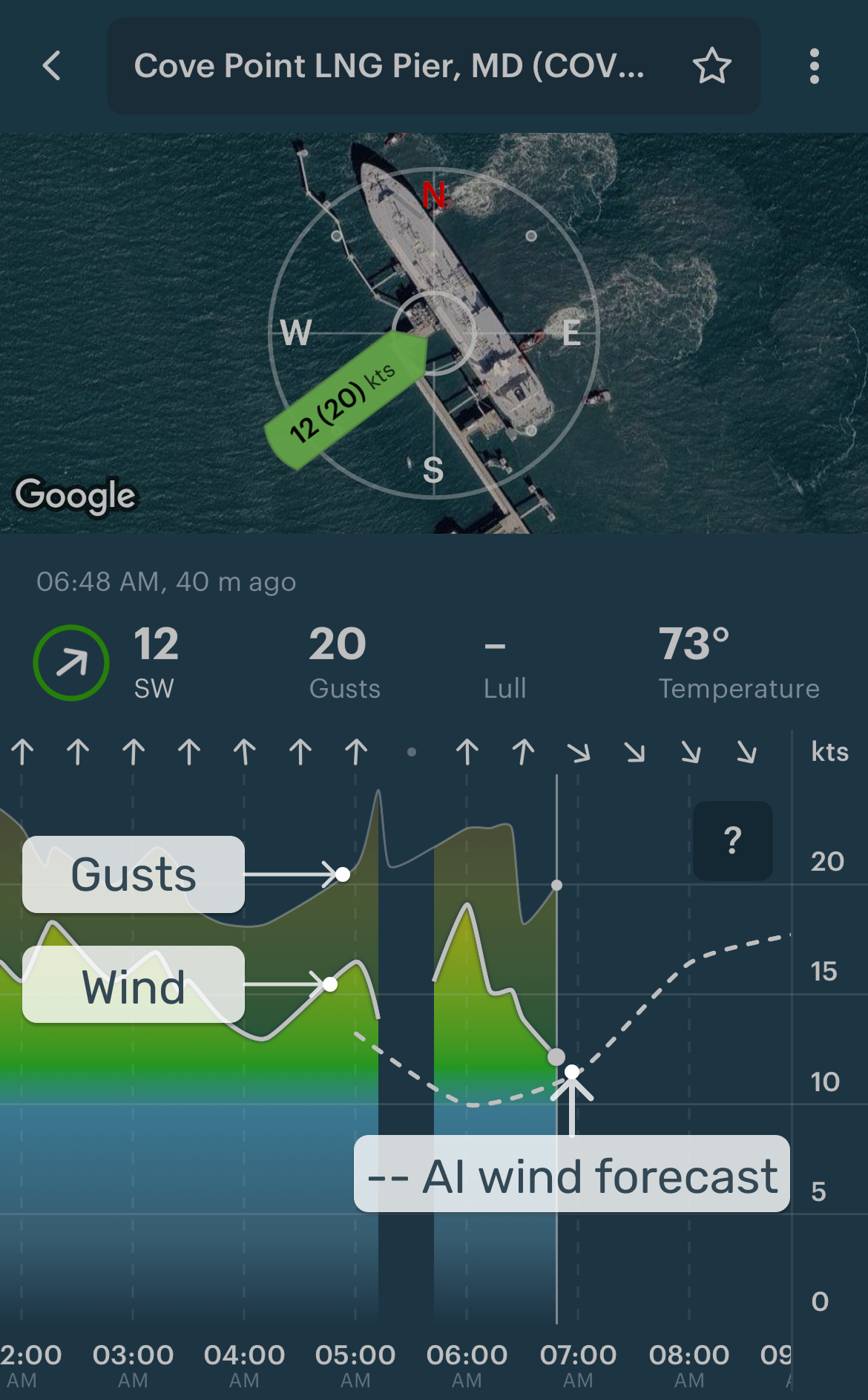
How to read live wind:
- Does it match the forecast?
- Is it increasing or dropping?
- Check gusts — they can be a game-changer.
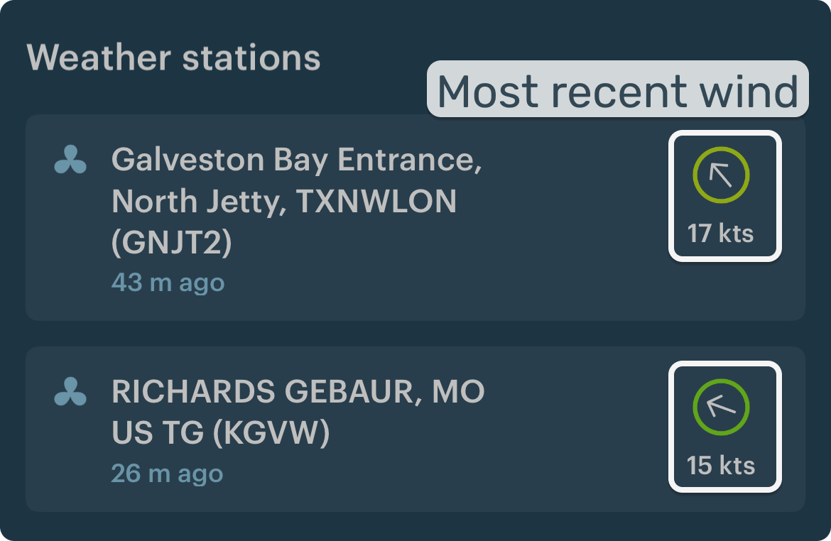
No need to find the weather station on the map. The nearest ones are just below the forecast table:
3) The freshest forecast check
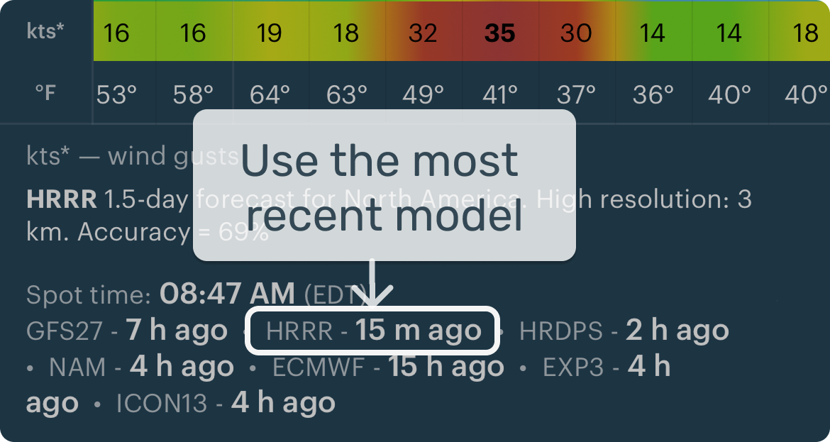
Check which model was updated last (shown under the forecast table). Has it changed?
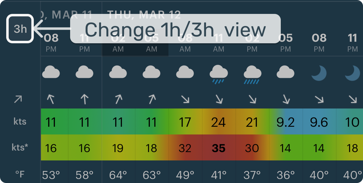
When timing is important, switch from a 3-hour forecast step to a 1-hour step for easier planning.
Meteorologist tip: Fresh forecasts include the most recent observations — in fast-changing weather, this can make a real difference.
3. App's main screens
These screens help you go from "what's the weather?" to a clear plan.
1) Main screen
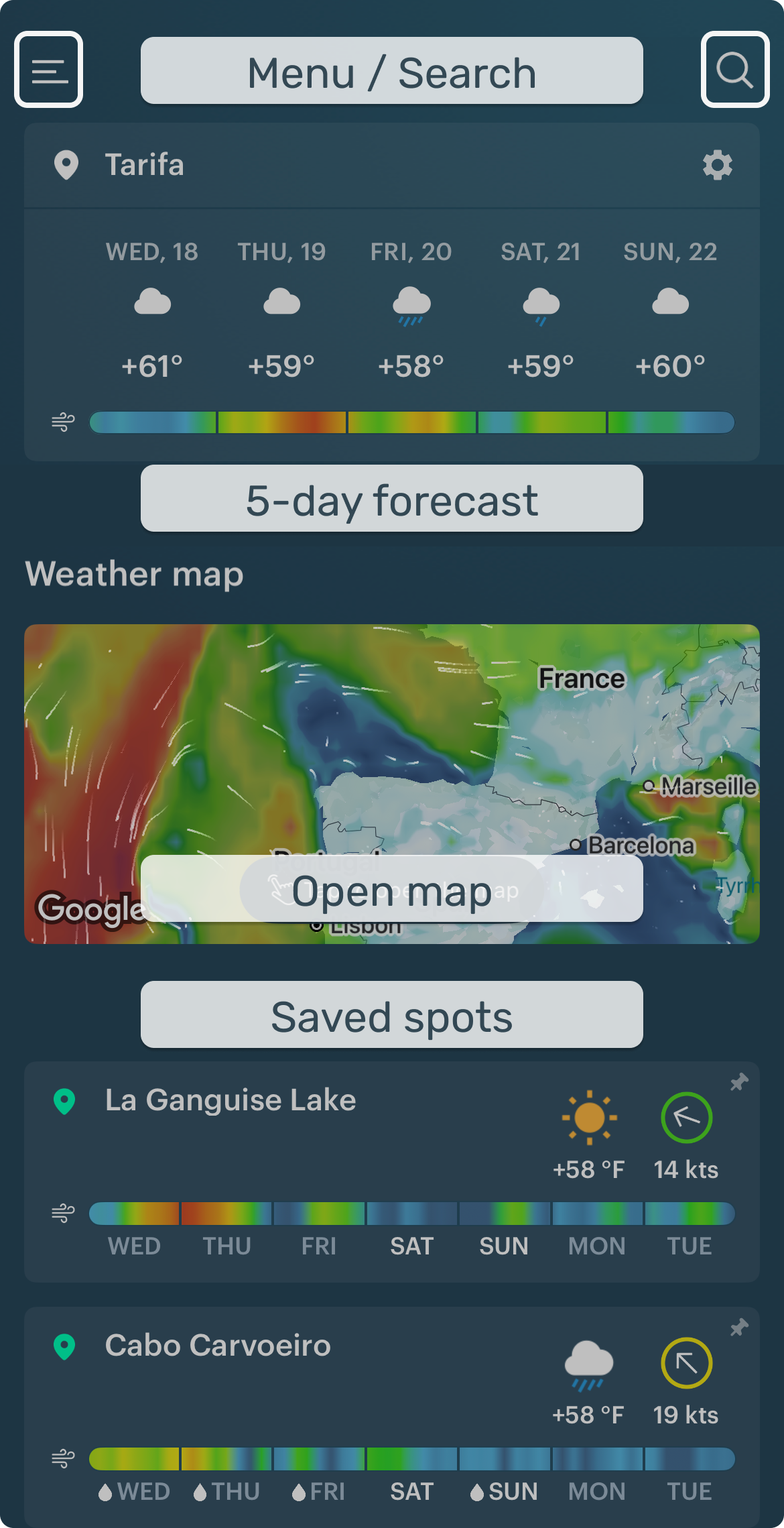
Quickly open forecasts for your favorite spots, jump to the Weather Map, or search for a new spot. Menu → settings, account, support.
2) Weather map
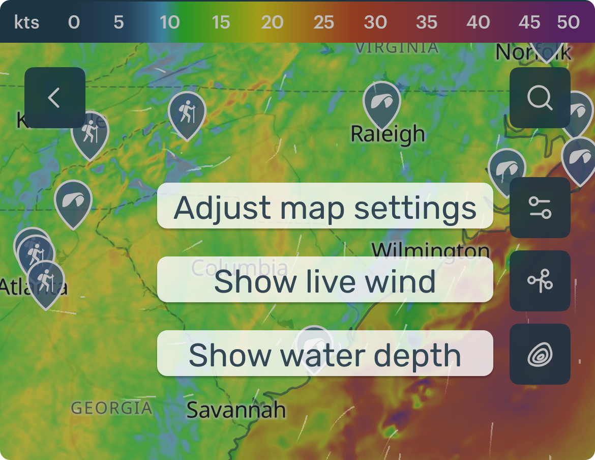
Layers control WHAT you see (wind, rain, waves). The timeline controls WHEN. Some layers can come from different forecasting models, like HRRR.
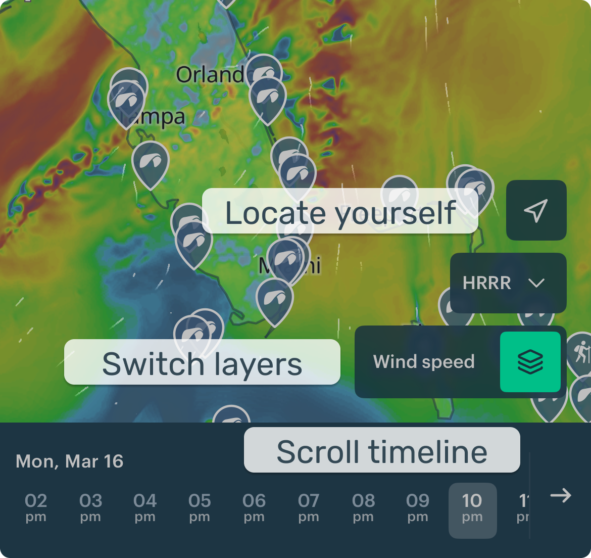
Settings control HOW the map looks (base map, spots, etc.).
3) Spot forecast
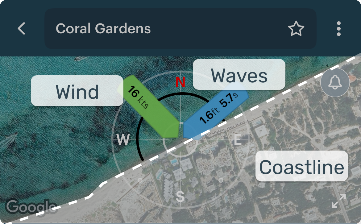
Use this screen to check conditions, understand the spot, and pick the best time.
Wind rose
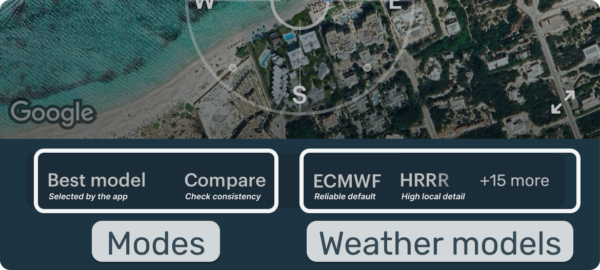
Model / Mode picker
Windy bar
Forecast table
Nearest weather stations
4) Live wind screen
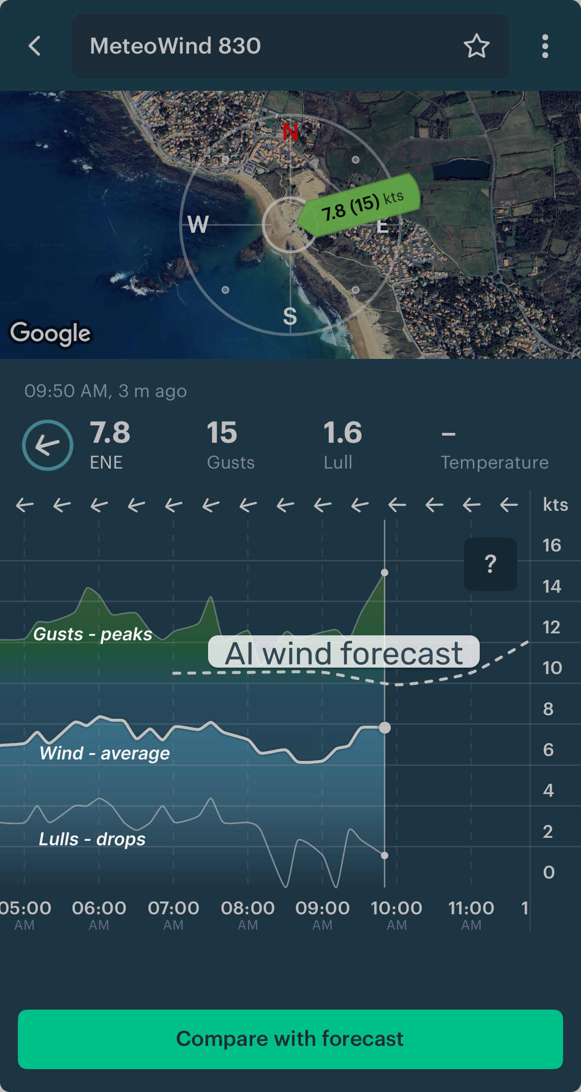
An example of live wind (updated as often as every minute) from a weather station:
- It's real data, not a forecast
- It helps confirm or adjust your forecast
- It shows trends (building or dropping wind)
- It tells you when the wind is finally what you need — so you can head to the spot
Set up Windy.app for faster forecast reading:
- Add your regular spots and weather stations to Favorites.
- Customize the Spot Forecast table to show the parameters you care about.
- Use weather overlays for context (fog, hurricanes, fronts, isobars).
4. Weather models — key to accuracy
Forecasts come from weather models (like ECMWF or GFS). Windy.app has 15+ of them — the best in the world.
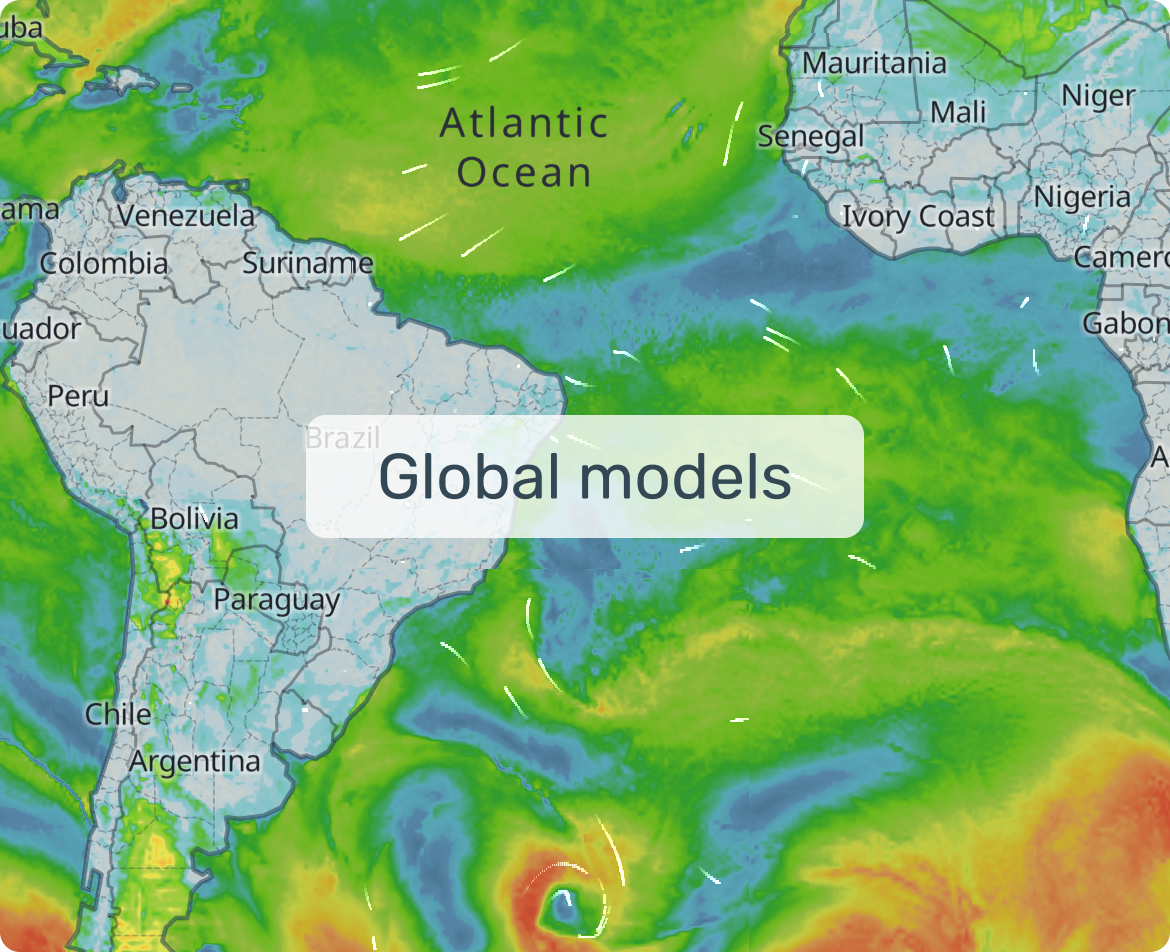
- Global models (long-term, but coarse)
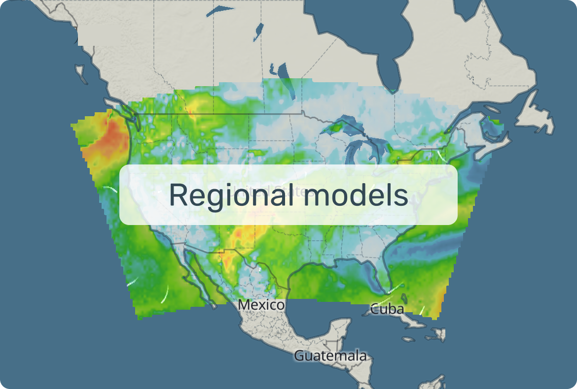
- Regional models (mid-range, mid detail)
- Local models (short forecast, great detail)
Why check more than one: different models suit different needs; agreement = confidence; disagreement = be cautious.
How to get the most accurate forecast for your spot:
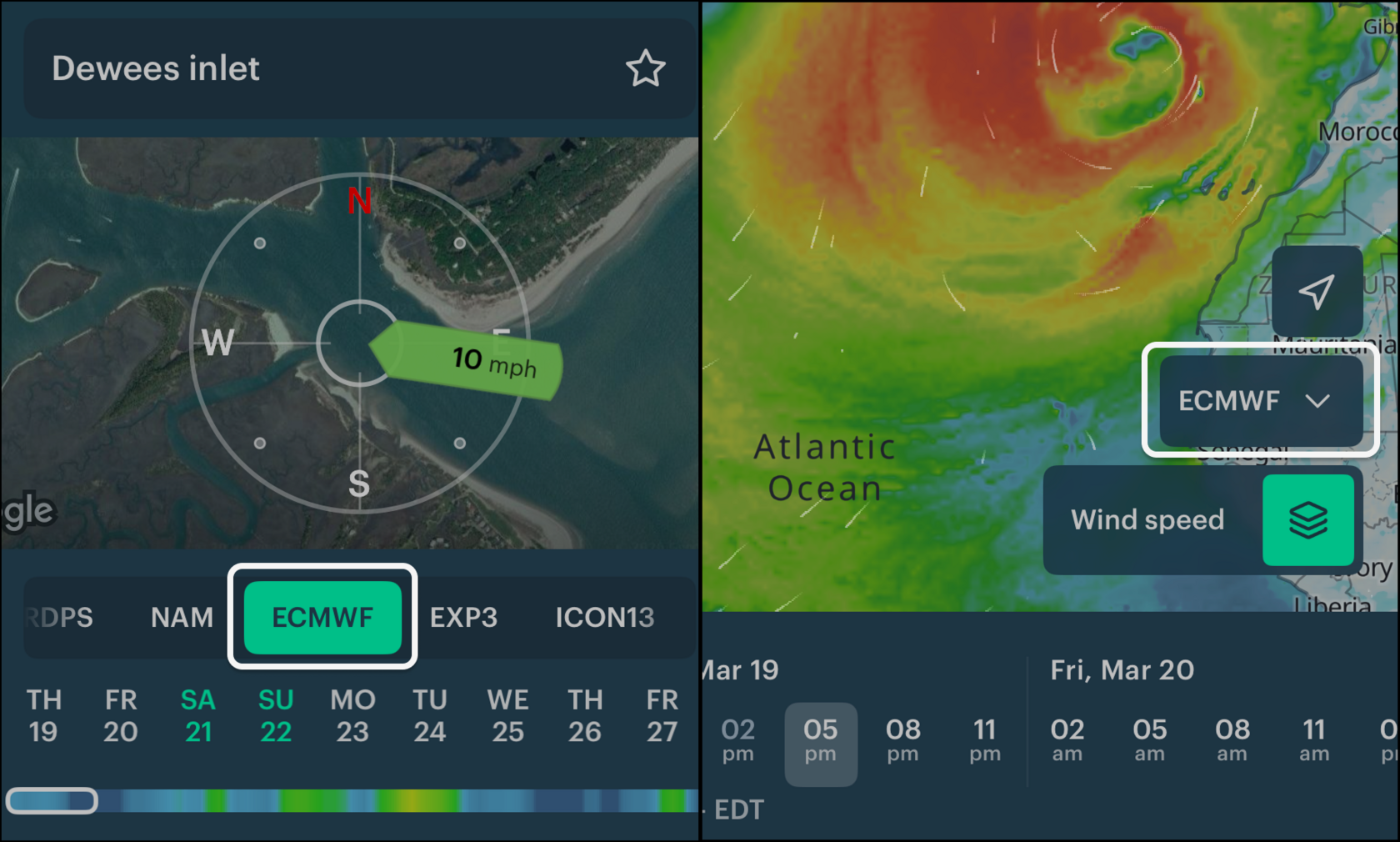
- Start with ECMWF (best overall). Find it in the model menu on the spot or map:
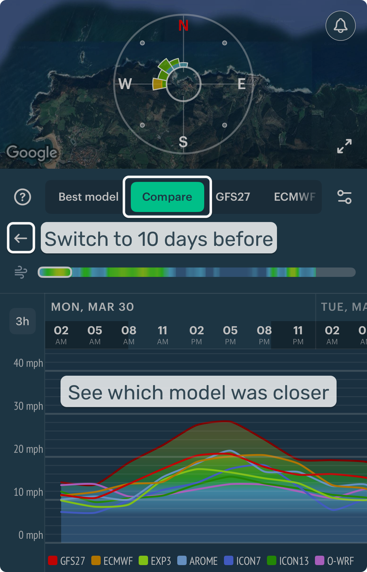
- For more accuracy, choose Best model — the one that worked best here in the last 10 days. HRRR is great but only covers 1.5 days ahead, so we add ICON13 to extend it.
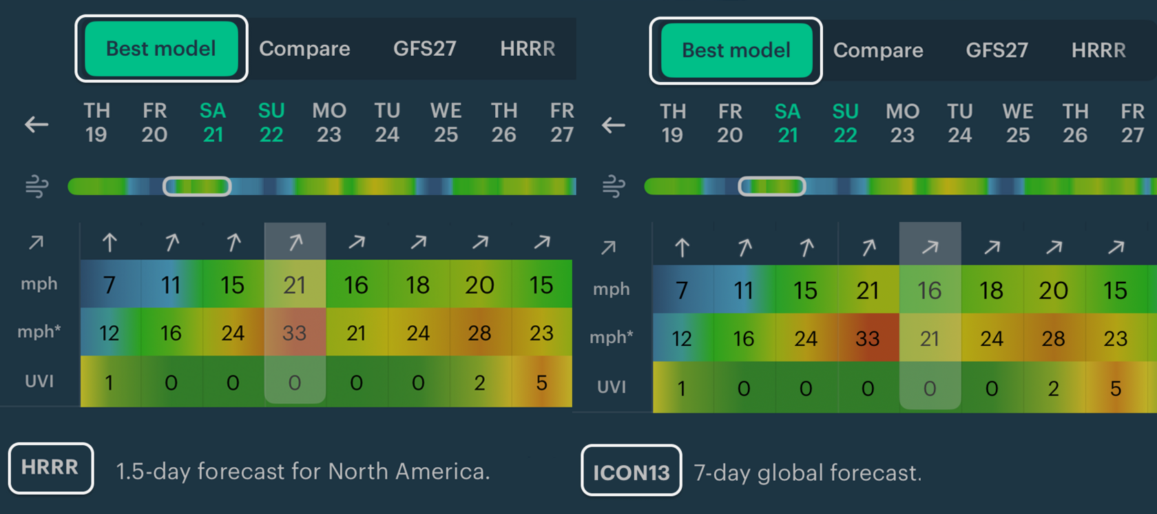
Meteorologist tip: "Best model for this spot" means it matched the wind here best in the last 10 days. Accuracy varies by spot and conditions, so the "best" model may change.
- If you have a local or regional model, check it too. They capture coastal, mountain, and valley effects better.
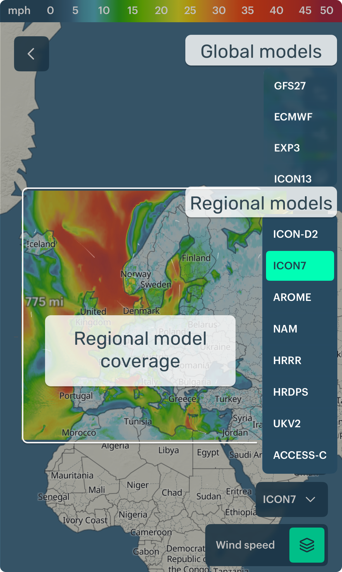
- If no local models — compare GFS27, ICON13, and EXP3 on the coast.
- For confidence, compare all models using the Compare tab.
Meteorologist tip — compare models especially when:
- Wind or rain is close to your go/no-go threshold
- Storms are possible
- Forecasts change a lot between updates
If you followed every step — does that mean forecasts will never be wrong? Unfortunately, no. Here's what to do when they miss:
Meteorologist tip — do a quick post-check:
If there's a weather station nearby, compare the forecast to actual wind:
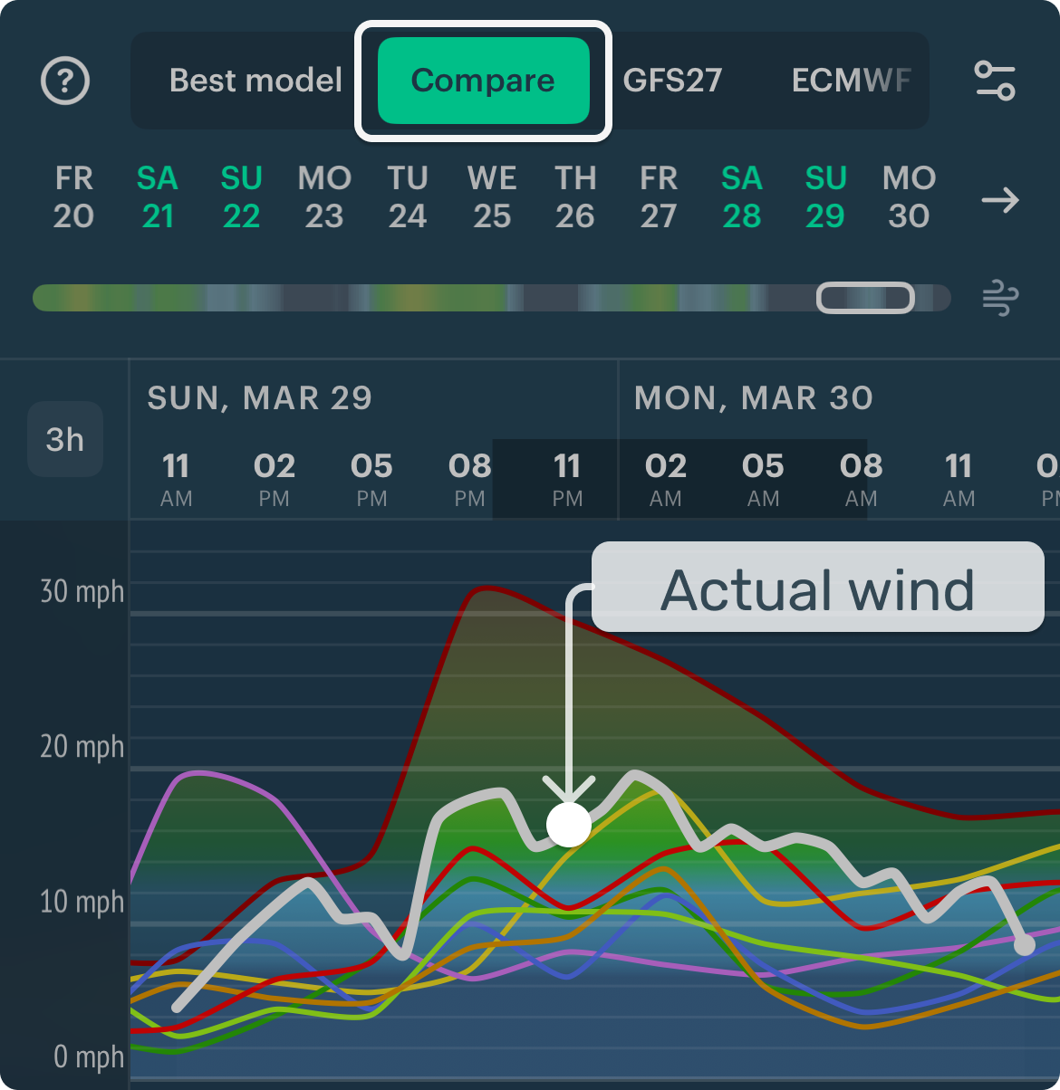
- Which model was closest?
- Was the timing wrong, the strength wrong, or both?
Pick those models next time for this spot.
5. Mini glossary
Use this section if something is unclear or unfamiliar.
Weather model names, strengths, and specs
| Model | Best for | Pick this when… | Watch out for |
|---|---|---|---|
| ECMWF (10 days) | ✅ Beginners. #1 for most decisions | Your first look | May miss very local effects |
| GFS27 (10 days) | #1 for oceans and long-term trends | Second opinion, bigger picture | Less detail in complex terrain |
| ICON13 (7.5 days) | #1 for complex terrain | Coastal and mountain spots | Can over/underestimate on calm days |
| GFS+ (10 days) | #1 for quick coastal wind check | Watersports reality check | May overestimate in calm conditions |
| EXP-3 (10 days) | #1 for coastal details | Coastlines, channels, terrain winds | Evolving model |
| Model | Best for | Pick this when… | Watch out for |
|---|---|---|---|
| ICON7 (5 days) | #1 Europe regional default | Planning a few days ahead | May miss breezes and terrain effects |
| EXP-3 (10 days) | #1 for coastal details | Coastlines, channels | Evolving model |
| NAM (61h) | #1 for US broader view | Second opinion, next 1–2 days | Underestimates local effects |
| Model | Best for | Pick this when… | Watch out for |
|---|---|---|---|
| HRRR (36h) | US day-of: showers, squalls, gusts | Day-of decisions | Wind patches over flat terrain |
| HRDPS (48h) | Canada: channeling winds | Canadian coasts and straits | Less reliable for showers |
| AROME (42h) | France: breezes, valley winds | Day-of decisions in France | Thunderstorm location may shift |
| ICON-D2 (27h) | Germany: föhns, valley breezes | Short-range in Germany | May overestimate heavy rain |
| UKV-2 (54h) | UK timing: fronts and fast changes | When a front is approaching | Timing can be off in fast storms |
| OpenSkiron (5d) | Mediterranean route planning | 3–5 day route planning | May miss breezes |
| OpenWRF (2d) | Mediterranean cross-check | When models disagree near-term | Less reliable in fast changes |
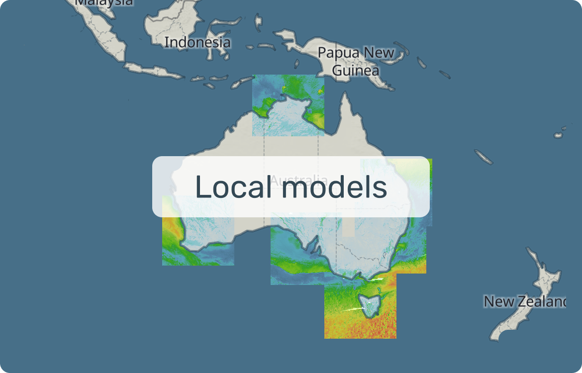
| ACCESS-C (36h) | Australia coasts | Short-range Australian coast | Only parts of Australia |
Meteorological terms
Wind direction: Where wind blows from. "North wind" blows from north to south.
Gusts: Short peaks in wind speed — often decide whether conditions feel manageable.
Radar: Real precipitation right now, not a forecast.
Nowcasting: Short-term estimate based on recent observations (often used with radar).
Weather station: Live report of wind, gusts, and direction at a real location.
Front: Boundary between air masses. Linked to wind shifts, showers, and fast changes.
Isobars: Pressure lines. Tighter spacing = stronger wind.
Wave height: How big the sea is expected to be.
Wave period: Time between waves. Longer period = more powerful waves.
Wave direction: Where waves come from — changes which spots are exposed.
Sea / land breeze: Local winds from land–water temperature difference. Build during the day, weaken after sunset.
Local winds: Driven by terrain, heating, or cooling. Can differ a lot from the regional forecast.
Wind shadow: Weaker-wind area behind an obstacle. Lighter and gustier near the edges.
Tunnel effect: Wind speeds up through narrow gaps (passes, straits, valleys). Expect stronger winds and sharper gusts.
Global model: Worldwide coverage, lower detail.
Regional model: Smaller area, greater detail.
Resolution: How detailed the model grid is. Smaller km = more local detail.
6. Help and support
Email support: windy@windyapp.co — a friendly and knowledgeable team, happy to help!
↑ Back to navigation